


GeoSwath 4R offers the industry’s most efficient simultaneous swath bathymetry and side scan seabed mapping system for shallow water. Bathymetry data accuracies have been shown to exceed the IHO Standards for Hydrographic Surveys, while providing seafloor coverage of up to 12 times the water depth and data from nadir to the waterline. The side scan data can be calibrated for repeatable results to provide seabed classification and monitoring.
Features
Ultra high resolution wide swath bathymetry with increased data density


A Sound Velocity Profiler measures the speed of sound throughout the column of water. Sound velocity in water is measured by either using a small acoustic signal which is sent to a receiver at a known distance or by measuring the variables affecting sound velocity in water; salinity, temperature and pressure variables.
Valeport SWiFT SVP is designed for coastal, harbour and inland hydrographic survey use, the SWiFT SVP makes a seamless workflow a reality in a compact, robust and portable package. Rated to 500m as standard with 0.01% FS accuracy, it has integral GNSS to geo-locate every profile. This new compact unit features high accuracy SV, Pressure and Temperature as normal, and adds integral GNSS, re-chargeable battery, LED status indications for GNSS, battery and communications. Data can be easily and quickly downloaded and reviewed wirelessly, via Bluetooth®, using Valeport’s new Ocean software for Windows and ConnectPathway Edition for iOS and Android and instantly shared, in industry-standard data formats through email and cloud services. Battery endurance is up to a week with easy charging via USB, a USB Cable and Bluetooth adapter are provided.


Valeport’s Tidemaster is the cost-effective way to accurately record water height, with the added option of gathering meteorological data using its ultrasonic wind speed and direction sensor.
This small Water Level Recorder, suitable for use in fresh or salt water, can be deployed for up to one year, dependent on the sampling rate. Instrument set-up and data retrieval is via a display panel or the PC software supplied. Alternatively, the system can be supplied with radio modules for real-time data transmission.


The small and sophisticated design of the stable aluminum housing offers various integration possibilities with platforms that offer restricted space or payload capabilities. The 360° field of view allows complete acquisition of the environment.
An easy-to-remove SD card for data storage, and/or the option for streaming the scan data via LAN-TCP/IP interface, in combination with the modest power consumption of the scanner, enable straight-forward integration with most UAS/UAV/RPAS types.
In addition to the stand-alone version of the miniVUX-1UAV, RIEGL also offers system solutions with IMU/GNSS systems and cameras fully integrated.


These terminals represent the interface towards operating all the departmen’s ecquipment in the field concerning the MBES (Multibeam Echosounder), LiDAR (Light Detection and Raging), UAV’s (Unmanned Aerial Vehicles), Sound Velocity Profiller, Gauge Staton etc.


The S631 receiver is powered by Athena RTK technology. With Athena, S631 provides state-of-the-art RTK performance when receiving corrections from a static base station or network RTK correction system. With multiple connectivity options, the S631 allows for RTK corrections to be received over radio, cell modem, Wi-Fi, Bluetooth, or serial connection. S631 delivers centimeter-level accuracy with virtually instantaneous initialization times and cutting-edge robustness in challenging environments.


The AQUAscat transmits pulses of high frequency sound on up to four transducers, each of which may operate at a different frequency. It measures the sound scattered by sediment or other suspended materials at discrete spatial intervals programmable from 2½ millimetres to 4 centimetres. For altimetry, this may span a few tens of centimetres; for monitoring sediment suspension profiles, a total range of around 1- 2 metres is typical; while dredge plume estimation may extend to 10 metres.


Wireless weather station with a versatile sensor suite that combines the rain collector with temperature and humidity sensors and anemometer in one package. The Vantage Pro can be customized by adding consoles or special feature options. It records the following parameters:


An intelligent and yet compact Unmanned Aerial Vehicle (UAV) that aims in upgrading the orthomosaics of the studied areas, especialy for vegetation aplication.
An uprated camera is equipped with a 1-inch 20-megapixel sensor capable of shooting 4K/60fps video and Burst Mode stills at 14 fps.The adoption of titanium alloy and magnesium alloy construction increases the rigidity of the airframe and reduces weight. The FlightAutonomy system adds dual rear vision sensors and infraredsensing systems for a total of 5-direction of obstacle sensing and 4-direction of obstacle avoidance.


Autel Robotics EVO 6K and 8K Camera Drone is Autel’s flagship product in the drone series. It is equipped with AI super-sensitivity impact technology pioneered by Autel, 20 million pixels, and can change exposure and depth of field through an adjustable aperture of f/2.8-f/11. The 1-inch CMOS image sensor and Autel’s intelligent algorithm provides high-quality multimedia products for mapping the investigated areas, from where the flight takes place, with an endurance of approximately 18 minutes under normal conditions.


The Matrice 300 RTK is DJI’s latest comercial drone platform that takes inspiration from modern aviation systems. Offering up to 55 minutes of flight time, advanced AI capabilities, 6 directional sensing and positioning and more, the M300 RTK sets a whole new standard by combining intelligence with high performance and unrivaled reliability.
The AlphaAir 450 (AA450) is a major breakthrough in 3D mobile mapping technology, allowing its use by non-professional users in geospatial reality capture applications and to those who have never been able to access such technology before. The AlphaAir 450 offers ease of use and high precision capabilities at an affordable price point.
AlphaAir 450 is the next generation of CHCNAV LiDAR system, which is widely used for power line inspection, topographic mapping, emergency response, agricultural and forestry surveys, and more. This all-in-one, lightweight and rugged system integrates a high-performance laser scanner with an industrial-grade professional 26 MP camera and a high-precision inertial navigation system for quality data collection.


Marlyn is the latest mapping & surveying drone by Atmos UAV, which makes a great leap forward compared to others. By reliably combining helicopter flexibility and fixed-wing performance, Marlyn maps more land in less time, with the accuracy you need.
Atmos UAV’s ultimate goal is to give professionals across all industries access to the skies, enabling them to further increase their business effectiveness by gathering data in a safer and more efficient way.
With Marlyn, mapping jobs consist of four easy steps. First, a flight plan is generated based on the required accuracy and the specified project area. Secondly, the drone starts its flight and data collection by a simple push of a button. Thirdly, after Marlyn has landed at the designated spot, the captured data is automatically organized and processed by image processing software of choice. Finally, a detailed analysis can be done to provide actionable insights.
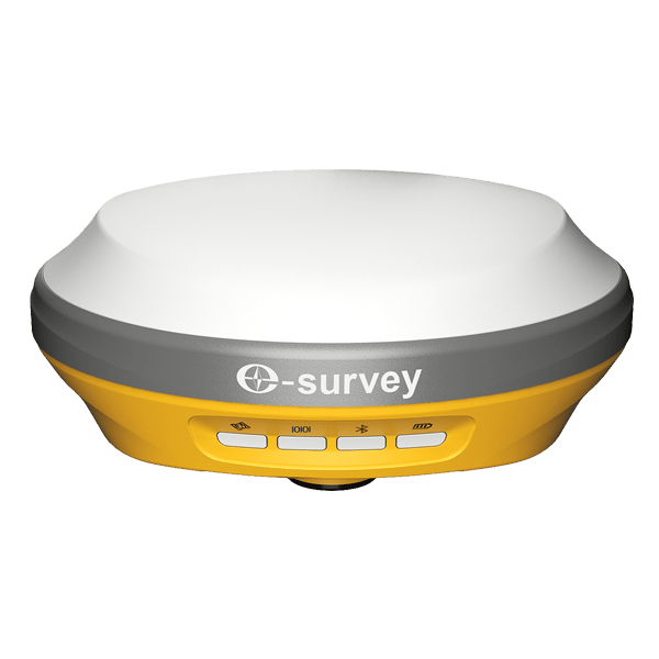
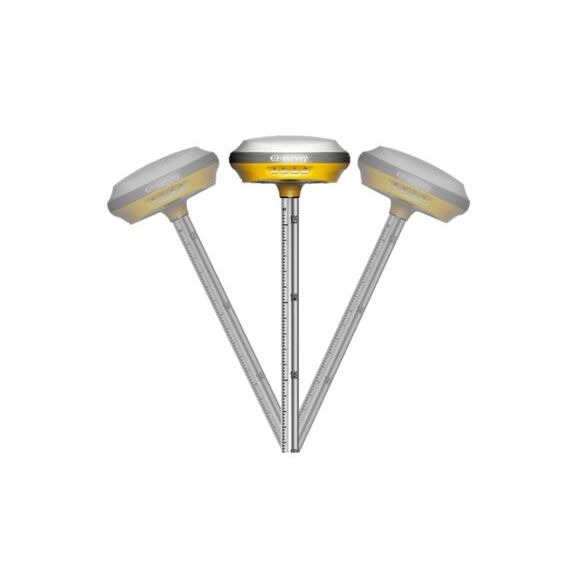
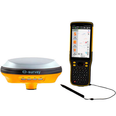
With a durable design, it allows operation in various environments. The e-Survey E100 is an 800-channel GNSS receiver capable of tracking multiple satellite systems: GPS/GLONASS/BEIDOU/GALILEO/QZSS/SBAS. It features a built-in 6800 mAh battery with fast USB Type-C charging, Wi-Fi, Bluetooth, 4G-LTE support, an IMU tilt sensor, and the SUREFIX function.
It allows connection with ROMPOS and comes with the latest TransDat version implemented. Inclues PDA terminal NAUTIZ X6 and the data acqusition is done by using SurPad application.
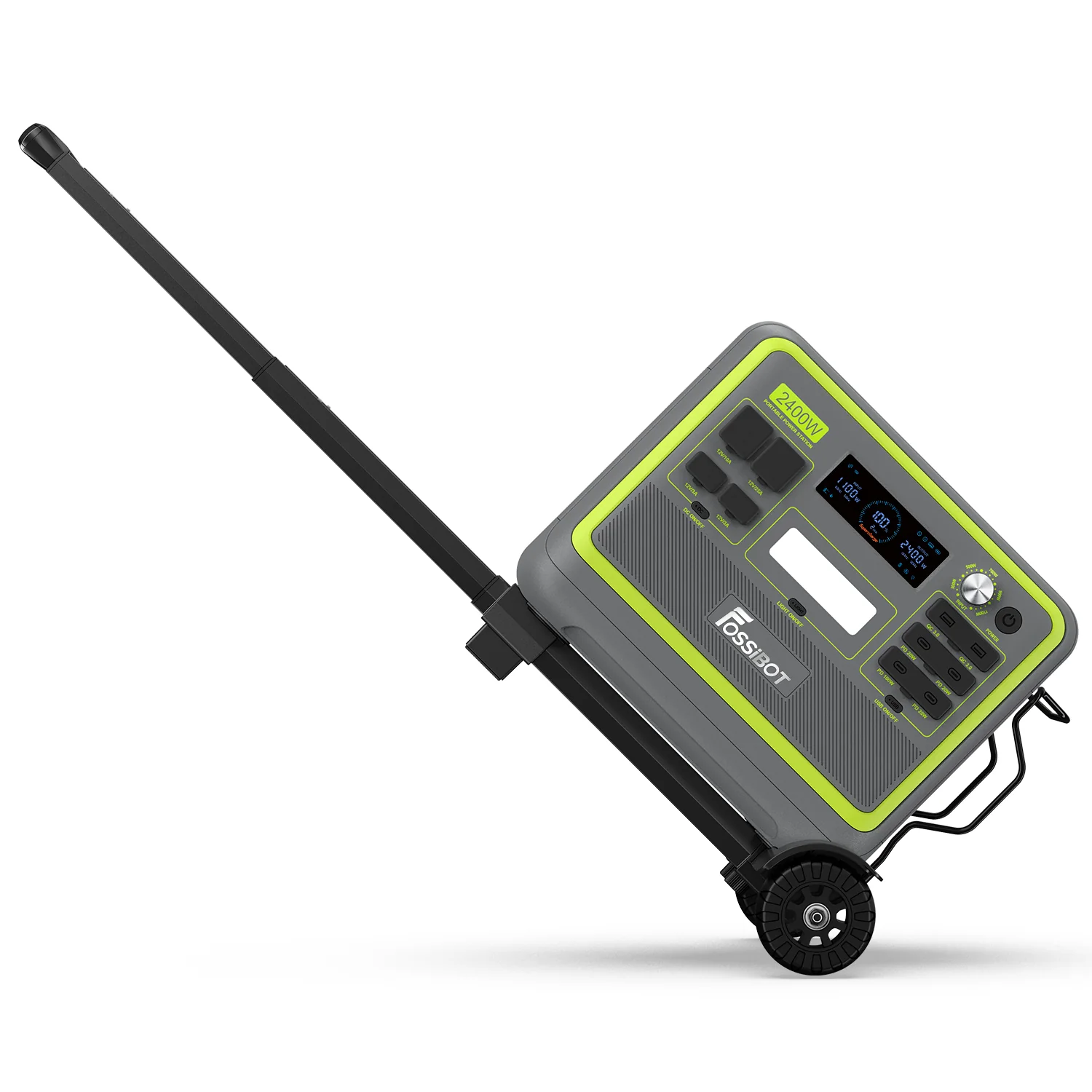
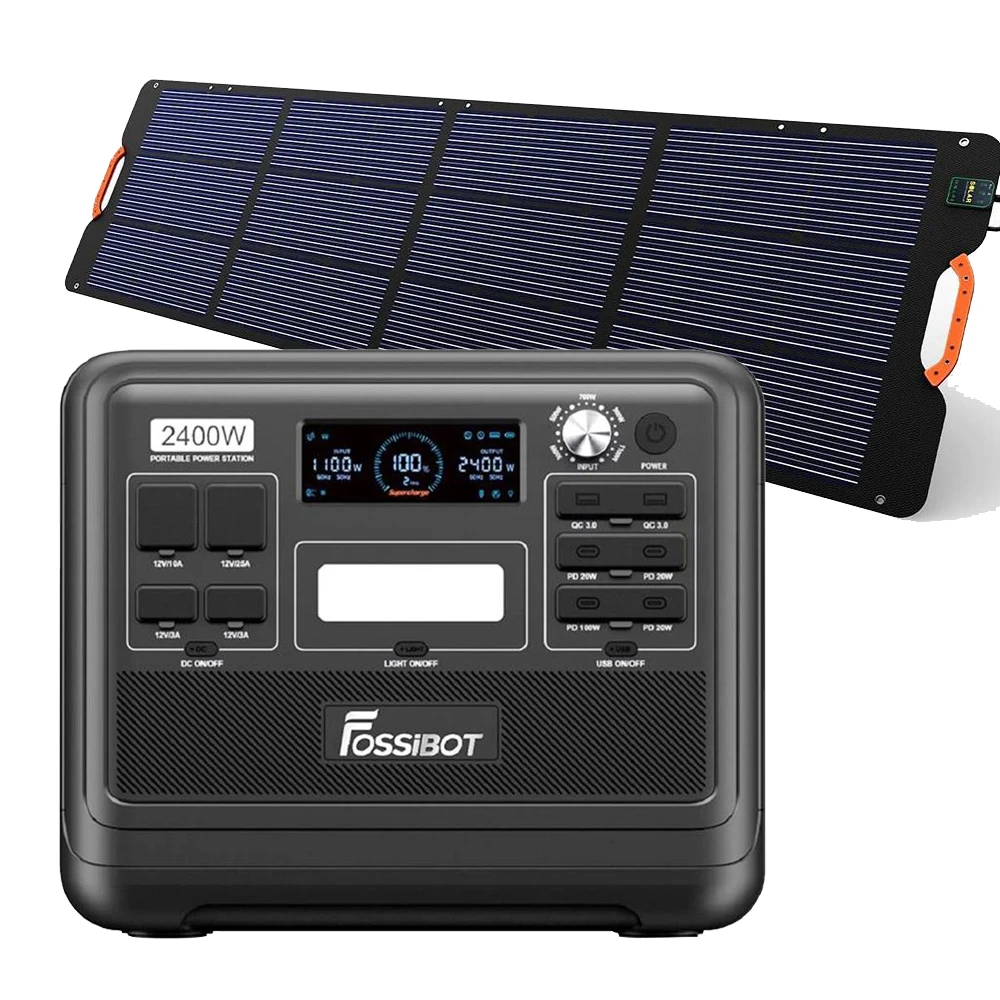
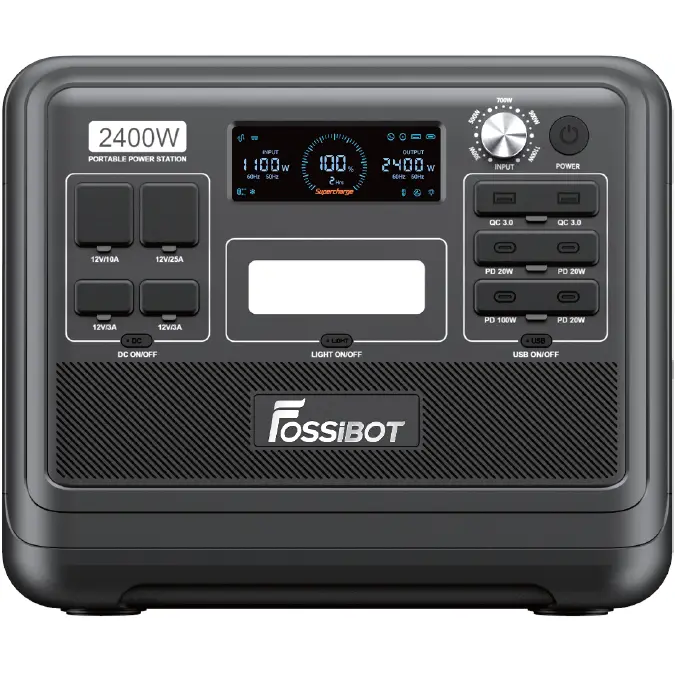
The Fossibot F2400 is a high-capacity portable power station, ideal for use in camping, fieldwork, or emergency situations. The set includes a foldable solar panel for eco-friendly charging and a sturdy transport trolley, ensuring greater mobility and ease of use. Its compact design and advanced functionality make the Fossibot F2400 a complete solution for powering electrical equipment in the field, providing the necessary energy flow for charging laptop batteries, phones, drones, GNSS receivers, and more.
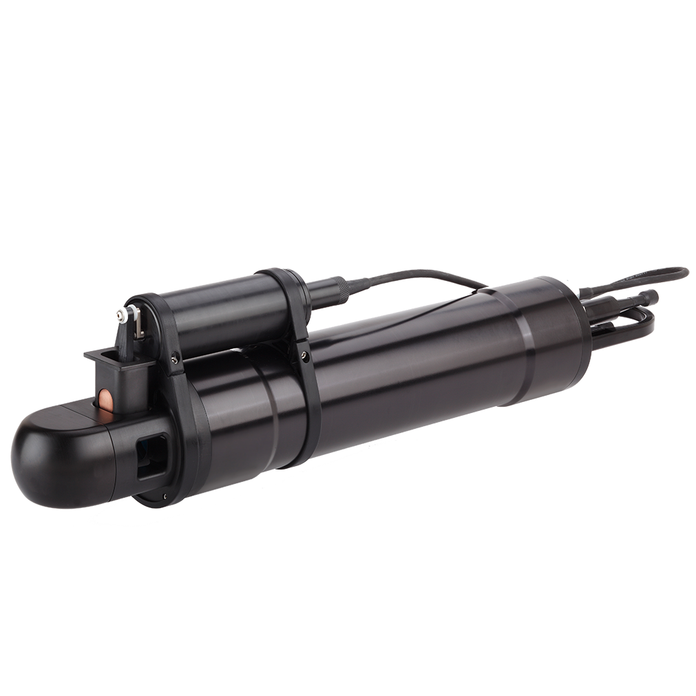
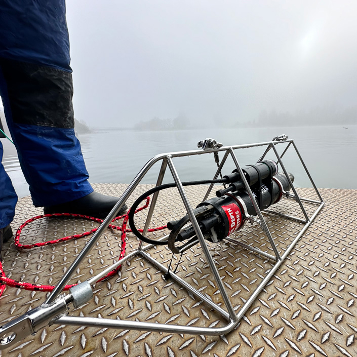
It is a self-contained submersible laser-diffraction based particle size analyzer, designed for measuring suspended particle size and concentration in the aquatic environment – oceans, rivers, lakes, streams. A fast response temperature sensor and a high-resolution depth sensor makes it suitable for profiling or towing. With Sequoia’s optional BioBlock accessory it can be deployed for months on moorings or landers for long-term studies. For the system integrator, the LISST-200X can power and accept inputs from up to three external analog sensors. The LISST-200X is typically used for sediment, (harmful) algae, oil-spill, ocean optics, visibility, dredging, aquaculture, environmental and laboratory applications.


ArcGIS is a geographic information system (GIS) for working with maps and geographic information. It is used for: creating and using maps; compiling geographic data; analyzing mapped information; sharing and discovering geographic information; using maps and geographic information in a range of applications; and managing geographic information in a database.
The system provides an infrastructure for making maps and geographic information available throughout an organization, across a community, and openly on the Web.


ERDAS Imagine is a remote sensing application with raster graphics editor abilities designed by ERDAS for geospatial applications. Imagine is aimed mainly at geospatial raster data processing and allows users to prepare, display and enhance digital images for mapping use in geographic information system (GIS) and computer-aided design (CAD) software. It is a toolbox allowing the user to perform numerous operations on an image and generate an answer to specific geographical questions.
By manipulating imagery data values and positions, it is possible to see features that would not normally be visible and to locate geo-positions of features that would otherwise be graphical. The level of brightness, or reflectance of light from the surfaces in the image can be helpful with vegetation analysis, prospecting for minerals etc. Other usage examples include linear feature extraction, generation of processing work flows (spatial models in Imagine), import/export of data for a wide variety of formats, orthorectification, mosaicking of imagery, stereo and automatic feature extraction of map data from imagery.


HYPACK – A Xylem Brand and now part of YSI is a Windows based software for the Hydrographic and Dredging Industry. Founded in 1984, HYPACK, INC (formerly Coastal Oceanographics, Inc.) has evolved from a small hydrographic consultant to one of the most successful providers of hydrographic and navigation software worldwide. HYPACK® is one of the most widely used hydrographic surveying packages in the world, with more than 10,000 users. It provides the Surveyor with all the tools needed to design their survey, collect data, process it, reduce it, and generate final products. Whether you are collecting hydrographic survey data or environmental data, or just positioning your vessel in an engineering project, HYPACK® provides the tools needed to complete your job. With users spanning the range from small vessel with just a GPS and single beam echosounder to large survey ships with networked sensors and systems, HYPACK® gives you the power needed to complete your task in a system your surveyors can master.


QGIS is a user friendly Open Source Geographic Information System (GIS) licensed under the GNU General Public License. QGIS is an official project of the Open Source Geospatial Foundation (OSGeo). It runs on Linux, Unix, Mac OSX, Windows and Android and supports numerous vector, raster, and database formats and functionalities. QGIS is a volunteer driven project.


OpenDroneMap Authors ODM – A command line toolkit to generate maps, point clouds, 3D models and DEMs from drone, balloon or kite images. OpenDroneMap/ODM GitHub Page 2020 https://github.com/OpenDroneMap/ODM.
WebODM is a user-friendly, extendable application and API for drone image processing. It provides a web interface to ODM with visualization, storage and data analysis functionality.


The latest GS4 software has been exclusively developed for the GeoSwath 4. The GS4 software provides the complete project-based solution, and includes acquisition, storing and editing of sonar and ancillary data, data processing and advanced data gridding capabilities, side scan mosaicing and 3D data visualisation.
 Department: MANAGEMENT | GENERAL DIRECTOR / PRINCIPAL RESEARCHER
Expertise: Ecological Reconstruction, Habitats
Team: Management
Contact:
Email: office@ddni.ro
Tel.: +40240/524550 int.: 101

Principal researcher, licensed in Ecology and also PhD at “Ovidius” University from Constanta – Environmental Scienes faculty focusing onEnvironment Protection – Ecology. Had participated in over 15 specialized courses both national and international, coordinated over 14 national and international projects, published 19 ISI articles, one patent, published 14 papers at various acknowledged scientific events national and international, a book and 8 book chapters.
 Departament: DEZVOLTARE TEHNOLOGICA, TRANSFER TEHNOLOGIC SI PLANIFICARE SPATIALA
Expertiza: Desen Tehnic, Proiectare, Incarcare Baze de Date
Echipa: Dezvoltare Tehnologica, Transfer Tehnologic si Planificare Spatiala
Contact:
Email: mihaela.nichifor@ddni.ro
Tel.: +40240/524550 int.: 167
Mihaela Nichifor este Tehnician Proiectant in cadrul Institutul National de Cercetare-Dezvoltare „Delta Dunarii” din anul 1991 cu urmatoarele atributii: executarea lucrarilor de birou in domeniul proiectarii; fotointerpretare; gestiune si arhivare proiecte; activitate de secretariat; sarcivi cu caracter administrativ; documentare si colectare de date; verificarea calitatii documentelor, actelor si a materialelor studiilor de proiectare.
Department: TECHNOLOGICAL DEVELOPMENT, TRANSFER AND SPATIAL PLANNING
Expertise: Technician, Drawing Design, Database Loading
Team: Technological Development, Treansfer and Spatial Planning
Contact:
Email: mihaela.nichifor@ddni.ro
Tel.: +40240/524550 int.: 167
Mihaela Nichifor is a Research and Development Technician in “Danube Delta” National Institute since 1991 and the main attributions are: implementation of development projects; photointerpretation; administration and project archiving; secretatial activities; administrative tasks; documentation and data collection; quality check.
 Departament: DEZVOLTARE TEHNOLOGICA, TRANSFER TEHNOLOGIC SI PLANIFICARE SPATIALA
Expertiza: Modelare Hidraulica 1D2D, GIS
Echipa: Dezvoltare Tehnologica, Transfer Tehnologic si Planificare Spatiala
Contact:
Email: adrian.constantinescu@ddni.ro
Tel.: +40240/524550 int.: 134
Constantinescu Adrian Cornel este inginer IDT I cu specializare in modelare hidrologica si GIS. Are o experienta de 20 ani in modelare hidrologica utilizand softul specializat Sobek Rural 1D2D si 25 de ani in procesare GIS. Principalele realizari pe partea de modelare hidrologica sunt legate de participarea la proiecte FP si nationale:
– “ Centre of Excellence – DELWET” prin modelul hidraulic al Deltei Dunarii (inceput in 1997 si actualizat permanent) pentru care a primit Diploma Sesiunii Stiintifice Romane 2000 pentru „Modelul hidrologic al Deltei Dunarii”,
– FP5 “Nutrient Management in the Danube Basin and its Impact on the Black Sea – DANUBS”, prin modelul hidrochimic la Deltei Dunarii,
– “Redimensionarea ecologica a luncii Dunarii – REELD”, 2008 prin realizarea modelului hidraulic al Dunarii de la Gruia la marea Neagra,
– SEE- INTERREG IV B “STAKEHOLDER ORIENTED FLOOD RISK ASSESSMENT FOR THE DANUBE FLOODPLAINS (“DANUBE FLOODRISK”), 2009-2012 prin realizarea hartilor de hazard si risc la inundatii in lunca Dunarii de la Gruia la Marea Neagra,
– POS Mediu “Elaborarea unui suport cartografic digital de rezoluţie înaltă necesar implementării planurilor, strategiilor şi a schemelor de management în Rezervaţia Biosferei Delta Dunării” 2009-2012 prin modelul hidraulic al Deltei Dunarii si scenarii de renaturare,
– “MARS” project (Managing Aquatic ecosystems and water Resources under multiple Stress) funded under the 7th EU Framework Programme, prin modelarea lacurilor din Delta Dunarii utilizand Aquatox.
Principalele realizari pe partea GIS sunt legate de participarea la proiecte FP si nationale:
– Harti tematice ale Deltei Dunarii (vegetatie, sol, inundabilitate) pentru care a primit Nederlandse Vereninging voor Kartografie Technical Cartography Award 1994 for Danube Delta soil map,
– Phare-Ro “Establishment of an information system and a database for water management field according to the requirements of the water framework directive” 2008 prin harta retelei hidrografice a Romaniei si a statiilor de tratare/epurare a apei,
– PN II “Inventarierea pajistilor naturale cu biodiversitate ridicata din Romania in vederea fundamentarii stiintifice a masurilor de management pentru conservarea acestora-NARDUS” 2007-2010, prin procesarea GIS a hartilor,
– PN II „Harta Micropotenţialului Hidroenergetic al României – abordări complexe tehnico-economice HARMIH-RO” 2008-2010 pentru hartile hidrografice ale debitelor raurilor din Romania,
– Corine Land Cover (1995, 2000, 2006, 2012, 2018),
– A black Sea network promoting integrated natural Wastewater treatment systems – “WASTE-net” (Retea pentru Marea Neagra de promovare a sistemelor integrate de tratare naturala a apelor uzate), 2013-2015 pentru identificarea/evaluare potentialului utilizarii procedeelor naturale de epurare a apelor menajere ale localitatilor din Romania cu o populatie sub 2000 de locuitori,
– Program Nucleu 2016-2020 Elaborarea hărților de risc și hazard la inundații pentru localitățile din Delta Dunării.
Department: TECHNOLOGICAL DEVELOPMENT, TRANSFER AND SPATIAL PLANNING
Expertise: 1D2D Hydraulic Modeling, GIS
Team: Technological Development, Treansfer and Spatial Planning
Contact:
Email: adrian.constantinescu@ddni.ro
Tel.: +40240/524550 int.: 134
Adrian Constantinescu Cornel is an engineer specializing in hydrological modeling and GIS. He has 20 years of experience in hydrological modeling using specialized software Rural 1D2D Sobek and 25 years in GIS processing. The main achievements on the hydrological modeling are related to participation in FP and national projects:
– “Centre of Excellence – DELWET” by hydraulic model of the Danube Delta (beginning in 1997 and constantly updated) for which she received Diploma Romanian Scientific Session 2000 “hydrological model of the Danube Delta”
– FP5 “Nutrient Management in the Danube Basin and Its Impact on the Black Sea – DANUBS” by hydro chemical model in the Danube Delta
– “Resize ecological floodplain Danube – REELD” in 2008 by conducting hydraulic model of the Danube from the Black Sea Gruia,
– SEE INTERREG IVB “stakeholder FLOOD RISK ORIENTED ASSESSMENT FOR THE DANUBE FLOODPLAINS (” DANUBE FLOODRISK “), from 2009 to 2012 by making hazard maps and flood risk in the Danube Floodplain Gruia Black Sea
– SOP “Developing a high-resolution digital cartographic support needed to implement the plans, strategies and management schemes in the Danube Delta Biosphere Reserve” 2009-2012, by hydraulic model of the Danube Delta and scenarios of renaturation
– “MARS” project (Managing Aquatic Resources under multiple ecosystems and water stress) Funded under the EU 7th Framework Program, by modeling using Aquatox Delta lakes.
GIS on the main achievements are related to participation in FP and national projects:
– Thematic Maps of the Danube Delta (vegetation, soil, flooding) for which he received voor Nederlandse Vereninging KARTOGRAFIA 1994 Award for Technical Cartography Danube Delta soil map,
– Phare-Ro “Establishment of year and the database information system for water management field According to the Requirements of the Water Framework Directive” 2008, by hydrographic network map of Romania and potable water treatment / water treatment,
– PN II “Inventory of natural grasslands with high biodiversity in Romania in order to substantiate scientific management measures for their conservation-Nardus” 2007-2010 by processing GIS maps,
– PN II “Hydropower Potential Map of Romania – complex technical and economic approach HARMIH-E” hydrographic maps 2008-2010 for the flow of rivers in Romania,
– Corine Land Cover (1995, 2000, 2006, 2012, 2018),
– Promoting integrated network A Black Sea natural Wastewater treatment systems – “WASTE-net” (Network for the Black Sea to promote integrated systems for natural treatment of wastewater) from 2013 to 2015 for identifying / evaluating the potential use of natural water treatment processes household of localities in Romania with a population under 2,000 inhabitants,
– National Program 2016-2020 Develop risk maps and flood hazard to localities in the Danube Delta.
 Departament: CENTRUL DE INFORMARE TEHNOLOGICA „DELTA DUNARII”
Expertiza: Monitorizarea şi managementul mediului, Turism, Informare si Transfer Tehnologic, Organizare Evenimente Stiintifice
Echipa: CENTRUL DE INFORMARE TEHNOLOGICA „DELTA DUNARII”
Contact:
Email: edward.bratfanof@ddni.ro
Tel.: +40240/524550 int.: 126
Edward Bratfanof – Facultatea de Silvicultură și Exploatări Forestiere, Universitatea Transilvania din Brașov (5 ani), licențiat în: Ingineria Mediului (1995). Un alt Master în Management și Monitorizare a Mediului (2016), Universitatea „Dunărea de Jos” din Galați. Doctorand în Inginerie Industrială – Universitatea „Dunărea de Jos” din Galați, intitulată „Studii privind impactul antropic asupra sturionilor la nivelul brațului Chilia din RBDD”. Coordonează activitățile specifice departamentului CIT DD din 2014, a elaborat Strategia de dezvoltare și Planul de afaceri al DD TIC. Obiective principale: Crearea unui pol de competitivitate și inovare în regiunea Dobrogea și promovarea sustenabilității în Delta Dunării, pentru care a contribuit la înființarea clusterului 3D Edaphic-BLOOM Dunărea. A fost implicat în numeroase proiecte precum: WETECOS, TARCHS, Restoration-DD Restoration of Sontea – Fortuna Wetland Ecosystems, Creating Interfaces – Belmont, Danubius RI – Support Project, Flood-Serv, Lucas, RAIN Solutions, ResponSEAble – Ocean Literacy, SCENT , Danurb+, Anadrom, BlueNIGHTs, EDAPHIC -BLOOM Dunărea, EcoDALLi, DaWetRest, Restore4Life și altele. Organizează numeroase evenimente științifice internaționale, naționale sau regionale, precum: Simpozionul Internațional „Deltas & Wetlands”, „Dialogii cu părțile interesate privind strategiile de dezvoltare durabilă: lecții, oportunități, studii de caz – 4 DELTA”.
Department: DANUBE DELTA TECHNOLOGICAL INFORMATION CENTER
Expertise: Environmental Management and Monitoring, Tourism, Technological Transfer and Information, Organizing Scientific Events
Team: DANUBE DELTA TECHNOLOGICAL INFORMATION CENTER
Contact:
Email: edward.bratfanof@ddni.ro
Tel.: +40240/524550 int.: 126
Edward Bratfanof – Faculty of Silviculture and Forest Engineering, Transilvania University of Brasov (5 years), licensed in: Environmental Engineering (1995). Another Master in Environmental Management and Monitoring (2016), “Lower Danube” University of Galati. PhD student in Industrial Engineering – “Dunărea de Jos” University of Galati, entitled “Studies on the anthropogenic impact on sturgeons in the Chilia arm of the DDBR”. He coordinates the specific activities of the DD TIC department since 2014, elaborated the Development Strategy and the Business Plan of the DD TIC. Main objectives: Creating a pole of competitiveness and innovation in the Dobrogea region and promoting sustainability in the Danube Delta, for which he contributed to the establishment of the 3D Edaphic-BLOOM Danube cluster. He was involved in numerous projects such as : WETECOS, TARCHS, Restoration-DD Restoration of Sontea – Fortuna Wetland Ecosystems, Creating Interfaces – Belmont, Danubius RI – Support Project, Flood-Serv, Lucas, RAIN Solutions, ResponSEAble – Ocean Literacy, SCENT, Danurb+, Anadrom, BlueNIGHTs, EDAPHIC -BLOOM Danube, EcoDALLi, DaWetRest, Restore4Life and others. He organizes many international, national or regional scientific events, such as: “Deltas & Wetlands” International Symposium, “Stakeholder dialogues regarding sustainable development strategies: lessons, opportunities, case studies – 4 DELTA”.
 Department: LABORATORIES AND RESEARCH BASES
Expertise: Aquatic Ecology, Zooplankton
Team: Hyrdobiology Laboratory
Contact:
Email: iasemin.suliman@ddni.ro
Tel.: +40240/524550 int.: 161
Iasemin Suliman, graduated from the Faculty of Natural and Agricultural Sciences “Ovidius” University of Constanța, in 2008.
In 2010 she graduate a Master degree in Management of Environmental Impacts. Since 2017 has been working at the “Danube Delta” National Institute for Research and Development, Tulcea as Research Assistant.
Currently she is scientific researcher in the team of the Hydrobiology Laboratory and PhD student at Doctoral School of Applied Sciences, “Ovidius” University of Constanța, She is involved in various projects that aim to evaluate the quality of aquatic ecosystems.
The main responsability being the study and characterization of zooplankton communities from the aquatic ecosystems of the Danube Delta.

Departament: LABORATOARE SI BAZE DE CERCETARE
Expertiza: Chimia Mediului, Geochimie si Biotehnologie
Echipa: Laboratorul de Chimie
Contact:
Email: cristina.despina@ddni.ro
Tel.: +40240/524550 int.: 136
Cercetător în cadrul INCDDD, Tulcea, Romania, doctor în Știința Materialelor din anul 2010, cu experiență în chimia mediului, impactul factorilor de mediu asupra prezenței micropoluanților organic și anorganici în ecosistemele acvatice, experiență în spectrometria de masă cu plasmă cuplată inductiv, gazcromatografie cu spectrometrie de masă, spectroscopie moleculară în UVVIS, absorbţie atomică cu vapori reci (CVAAS). A fost colaborator în numeroase proiecte naționale și internaționale și este autorul mai multor publicații în reviste cotate ISI (9), reviste indexate în baze de date internaționale (3) și coautor al unui capitol de carte.

Departament: LABORATOARE SI BAZE DE CERCETARE
Expertiza: Chimia Mediului si Geochimie
Echipa: Laboratorul de Chimie
Contact:
Email: liliana.teodorof@ddni.ro
Tel.: +40240/524550 int.: 186
Cercetător științific în cadrul INCDDD Tulcea și coordonatorul Departamentului Laboratoare și Baze de Cercetare. Este Licențiată în Chimie (Facultatea de chimie din cadrul Universității București, 1991) și Doctor în Chimie (Facultatea de chimie din cadrul Universității București, 2009). Are o vastă experiență în spectrometria de masă cu plasmă cuplată inductiv, gaz cromatografie/ spectrometrie de masă, spectroscopie moleculară în UVVIS, absorbţie atomică cu vapori reci și cu flacără, spectrometrie în infraroșu. Are o experiență de peste 26 de ani în evaluarea, acumularea și transferul poluanților în sistemul aer-apă de suprafață-sol/sedimente-floră și fauna terestră/acvatică, dezvoltare durabilă, evaluarea impactului de mediu. Este coautor la 6 cărți și la 4 capitole de carți, din care 2 ca prim autor. A publicat 13 articole publicate în reviste cotate ISI din care 6 ca prim autor, 1 articol în extenso într-o revistă indexată ISI, 8 articole extenso publicate în reviste indexate în baze de date internaţionale (BDI). A coordonat 8 proiecte/contracte naționale. Este membru B.EN.A– Balkan Environmental Association și membru I.A.D. – International Association of Danube River Research, Viena, Austria. A fost profesor asociat al Universității École Nationale Supérieure Agronomique de Toulouse (2002, 2004) și profesor asociat la Masterul Dezvoltare Durabilă și Protecția Biodiversității al Universității Tehnice de la Cluj.
Department: LABORATORIES AND RESEARCH BASES
Expertise: Environmental Chemistry, Geo-Chemistry
Team: Chemistry Laboratory
Contact:
Email: liliana.teodorof@ddni.ro
Tel.: +40240/524550 int.: 186
Research Scientist at DDNI Tulcea and the head of the Laboratories and Research Facilities Department. Has a degree in Chemistry (Faculty of Chemistry, University of Bucharest, 1991) and the scientific title of Doctor in Chemistry (Faculty of Chemistry, University of Bucharest, 2009). She has extensive experience in inductively coupled plasma mass spectrometry (ICP-MS), gas chromatography / mass spectrometry, UV-VIS molecular spectroscopy, atomic absorption with cold vapor and flames, infrared spectrometry. Her experience spans over 26 years in evaluation, accumulation and transfer of pollutants in systems such as air – surface-water – soil / sediments-flora and aquatic/terrestrial fauna, sustainable development, environmental impact assessment. Is co-author of 6 books and 4 book chapters. Has published 13 articles in ISI journals with impact factor, out of which 6 as first author, an article in extenso in an ISI indexed journal and 8 articles in IDB indexed journals. Has been the coordinator of 8 national research projects. Is a member of Balkan Environmental Association (B.E.N.A) and International Association of Danube River Research (I.A.D), Vienna, Austria. Was an associate professor at the School of Agricultural and Life Sciences of Toulouse, France (2002, 2004) and associate professor in the Master of Sustainable Development and Biodiversity Protection at the Technical University of Cluj.
 Departament: CONSERVAREA BIODIVERSITATII SI UTILIZAREA DURABILA A RESURSELOR NATURALE
Expertiza: Ornitologie, Resurse Cinegetice, Zoonoze (în care sunt implicate păsările și mamiferele), Ecologie, Mamalogie, Natura 2000, studii de impact asupra mediului
Contact:
Email: mihai.marinov@ddni.ro
Tel.: +40240/524550 int.: 157

Dr. Mihai Marinov (specialist în ornitologie, ecologie, zoonoze în care sunt implicate păsările și mamiferele, ecologie și Natura 2000) a terminat facultatea de Ecologie, în profilul de Biologice cu specializarea Ecologie, în anul 2002. În anul 2012 a susținut public teza de doctorat cu titlul ”Ornitofauna Rezervației Biosferei Delta Dunării și implicația acesteia în transmiterea virusului West Nile”, la București în cadrul Universității din București, în urma căreia obține titlul de doctor în Biologie. Lucrează în cadrul Institutului Național Delta Dunării din anul 2003, inițial în Departamentul de Biodiversitate (echipele de ornitologie și resurse cinegetice) iar din anul 2016 conduce Departamentul Centrul pentru Studiul Bolilor Transfrontaliere, Emergente si Zoonozelor. Principalele sale interese de cercetare sunt ecologia ornitofaunei din România, zoonozele în care sunt implicate păsările și mamiferele din Delta Dunării, resursele cinegetice și implementarea Rețelei Natura 2000 în România. Din perspectiva Departamentului pe care îl conduce, din anul 2005 și până în prezent cercetează ecologia virusului West Nile în colaborare cu Instituții din România, Franța, Austria, Spania, Italia, Republica Cehă, Marea Britanie și Ungaria (proiecte precum EDEN – FP6, EDENext – FP7, ROVETNILE – Biotech). Din perspectiva cercetării virusului West Nile, pe lângă investigații asupra speciilor rezervor și a vectorilor se ocupă și de realizarea de modele de prognozare a infecțiilor cu virusul studiat. Împreună cu colaboratorii a identificat speciile de păsări implicate în transmiterea virusului West Nile respectiv a identificat pentru prima dată în Europa prezența virusului West Nile într-o specie de Ixodidae. Actualmente, împreună cu instituții partenere din România lucrează la modelarea epidemiologie virusului West Nile prin monitorizare cu ajutorul dronelor (proiectul WNV-RPAS – PN II) respective instruiește doctoranzi din România și Serbia în domeniul tehnicilor de recoltare de material biologic și ecologia agenților patogeni din zone umede (proiectul AMSAR – SCOPE finanțare elvețiană). Pe lângă studiul virusului West Nile sunt realizate sau vizate studii, cercetări și proiecte cu privire la Pesta Porcină Africană, Boala Carre, Hepatita E, Gripa Aviară, Trichineloza, Encefalita de căpuşă, Febra hemoragică Crimeea-Congo, Febra hemoragică Dengue, Febra hemoragică Chikungunya ș.a.
Department: BIODIVERSITY CONSERVATION AND SUSTAINABLE USE OF NATURAL RESOURCES
Expertise: Ornithology, Game Resources, Zoonosys (in which are involved birds and mammals), Ecology, Mammalogy, Natura 2000, Environmental Impact Assessment
Contact:
Email: mihai.marinov@ddni.ro
Tel.: +40240/524550 int.: 157
PhD Mihai Marinov (specialist in ornithology, ecology, zoonosys in which are involved birds and mammals, ecology, mammalogy) has graduated in 2002 Faculty of Biology, Biology profile, Ecology Specialization. In 2012 he defended his PhD thesis entitled “The ornithofauna of Danube Delta Biosphere Reserve and its implication in the transmission of West Nile virus” at the University of Bucharest, after which obtained a PhD in Biology. He is working in the Danube Delta National Institute since 2003, initially in the Department of Biodiversity (Irnithology and Hunting and Game species teams) and from 2016 leads the Centre for the study of transborder and emergent diseases and zoonosys. His main research interests are ecology of birds, zoonosys involving birds and mammals in the Danube Delta, wildlife resources and implementation of the Natura 2000 Network in Romania. From the perspective of the Department he leads, since 2005 until now, he investigates the ecology of West Nile virus in co-operation with institutions from Romania, France, Austria, Spain, Italy, Czech Republic, Great Britain and Hungary (projects such as EDEN – FP6, EDENext – FP7, ROVETNILE – Biotech). From the perspective of West Nile virus research, in addition to investigations of reservoir and vector species, he deals with making forecasting models of infections with the studied virus. Together with collaborators he identified the bird species most involved in the transmission of West Nile virus, respectively, identifying for the first time in Europe the presence of West Nile virus in a species of Ixodidae. Currently, together with partner institutions in Romania he is working on modelling the epidemiology of West Nile virus by monitoring using drones (project WNV-PSUR – PN II), respectively, he trains PhD students from Romania and Serbia in techniques for harvesting biological material and ecology of pathogens in wet areas (AMSAR project – Swiss finance SCOPE). Besides the study of West Nile virus are conducted or targeted studies, research and projects on the African swine fever, distemper, hepatitis E, Avian Influenza, trichinosis, Tick borne encephalitis, hemorrhagic fever Crimean-Congo, haemorrhagic fever Dengue, hemorrhagic fever Chikungunya etc.
 Departament: SISTEM INFORMATIONAL SI GEOMATICA
Expertiza: Sisteme Informationale Geografice si Teledetectie
Echipa: SISTEM INFORMATIONAL SI GEOMATICA
Contact:
Email: ion.grigoras@ddni.ro
Tel.: +40240/524550 int.: 142
Dr. Ion Grigoras este cercetător ştiinţific gradul I şi coordonatorul Departamentului Sistem Informațional și Geomatică din cadrul INCDDD. Are expertiză în: baze de date, GIS și teledetecție, aplicaţii web aplicate pentru mediu. Are 33 de ani de experiență în domeniul IT, din care 26 a colaborat cu biologi pentru structurarea informației de mediu, în combinație cu alte date spațiale, inclusiv ortofoto și imagini satelitare. A participat ca expert GIS / teledetecție în proiecte de mediu localizate în Ucraina, Federația Rusă și Africa de Vest (1999-2005, 2016-2017) și a făcut parte din echipa care a coordonat Corine Land Cover 2000, 2006, 2012 pentru România. A fost coordonator al proiectelor care a realizat rețeaua Natura 2000 în România (2005-2012) si a proiectat prima versiune a bazei de date web pentru rețeaua Natura 2000.
Department: INFORMATIC SYSTEM AND GEOMATICS
Expertise: Geographical Informational Systems and Remote Sensing
Team: INFORMATIONAL SYSTEM AND GEOMATICS
Contact:
Email: ion.grigoras@ddni.ro
Tel.: +40240/524550 int.: 142
Dr. Grigoras Ion is senior researcher and head of Geomatics and Information Systems department at Danube Delta National Institute. Main expertise in: databases, GIS and remote sensing, web application applied in environment. He has 34 years experience in IT from which 26 working with biologists, structuring environment information in combination with other spatial data including LIDAR, orthophoto and satellite images. Was GIS / remote sensing expert in environmental projects located in Ukraine, Russian Federation and West Africa (1999-2005, 2016-2017) and in the team that coordinate the Corine Land Cover 2000, 2006, 2012 for Romania. He was coordinator of projects that set up Natura2000 network in Romania (2005-2016) and had designed the web Natura 2000 database.
 Departament: RESTAURARE ECOLOGICĂ ŞI REDRESARE SPECII
Expertiza: Teledetecție, Fotointerpretare, Reconstrucție ecologică
Echipa: Grupul de Cercetare Restaurare Ecologică
Contact:
Email: jenica.hanganu@ddni.ro
Tel.: +40240/524550 int.: 143
Jenică HANGANU, născut în 1956. Cercetător Științific Gr. I. Din anul 1984 lucrează la Institutul Național de Cercetare – Dezvoltare Delta Dunării, Tulcea, România. Principalele activități au fost cele de cartare a vegetației și solurilor, cartografierea și gestionarea ecosistemelor stuficole din Delta Dunării, teledetecție și fotointerpretare. A contribuit la elaborarea hărții solurilor din Delta Dunării si la producția hărților de vegetație din Delta Dunării. Proiectele Comisiei Europene pe care le-a coordonat sunt: EUREED II, REBECCA, EnviroGRIDS, Helm, MARS precum si proiecte nationale ale Agenției Europene de Mediu: CORINE Land Cover 2000, 2006, 2012 și NARDUS care a avut ca obiectiv inventarierea pajiștilor semi-naturale din România.
Department: ECOLOGICAL RESTORATION AND SPECIES RECOVERY
Expertise: Remote Sensing, Photo Interpretation, Ecological Reconstruction
Team: Ecological restoration Research Group
Contact:
Email: jenica.hanganu@ddni.ro
Tel.: +40240/524550 int.: 143
Jenică HANGANU, born in 1956. Senior scientist. Since 1984 he has been working for the Danube Delta National Institute for Research and Development, Tulcea, Romania. The main activities were focus on vegetation and soil survey and mapping, management of the Phragmites ecosystems in the Danube Delta, remote sensing and photo interpretation. He has contributed in the elaboration of the Danube Delta soil map and initiate and coordinate production of the Danube Delta vegetation maps. He was local coordinator of several EC projects: EUREED II – Dynamic and stability of the Phragmites Ecosystems – REBECCA, EnviroGRIDS, HELM and MARS. He has lead the national research project NARDUS dealing with inventory of semi-natural grasslands in Romania and was national coordinator of the CORINE Land Cover 2000, 2006 and CLC 2012 GMES / Copernicus Initial Operations (GIO) land monitoring 2011-2013 in the framework of regulation (EU) No 911/2010 – pan-European component EEA projects).

Departament: DEPARTAMENTUL CONSERVARE A BIODIVERSITĂŢII ŞI UTILIZARE DURABILĂ A RESURSELOR NATURALE
Expertiza: Pescării Ape Interioare, Evaluarea Stocurilor Peștilor de Apă Dulce, Ihtiologie, Pești Migratori, Resurse Naturale Acvatice, Ecologie Acvatică
Contacte:
Email: ion.navodaru@ddni.ro
Tel.: +40240/524550 interior: 163
Dr. Ion NĂVODARU este cercetător principal în cadrul departamentului Conservarea Biodiversității și Utilizarea Durabilă a Resurselor Naturale și liderul echipei de cercetare a Utilizării Durabile a Resurselor Naturale din Institutul Național de Cercetare – Dezvoltare Delta Dunării. El are 35 de ani de experiență în domeniul cercetării pescăriilor interioare de apă dulce, a publicat o carte, 14 capitole de carte, 86 de lucrări științifice și a prezentat mai mult de 100 de lucrări științifice. Actual, coordonează Programul National NUCLEU „Delta Dunării”, proiectului H2020 CERES – Schimbările Climatice și Resursele Acvatice Europene, de asemenea colaborează în proiectul H2020 denumit AQUACROSS- ”Cunoștințe, Evaluare și Management pentru Biodiversitatea Acvatică și Serviciile Ecosistemelor în acord cu politicile UE” și este membru în Comitetul de Management al Acțiuni COST CA15219 ”DNAqua-net „Dezvoltarea de noi instrumente pentru Bioassessment genetice a ecosistemelor acvatice din Europa”. De asemenea a fost responsabilul ca și partener la diferite proiecte finanțate de UE precum: PC6 (GEM-CON-BIO), PC7 (TESS), COST UE (CA635 INTERCAFE) și BSB – JOP pentru Marea Neagră în proiectul ”Black Sea e-Eye”. De-a lungul carierei a fost lider de pentru 22 proiecte naționale și colaborator în alte 14 proiecte. Ion este membru al Consiliului Consultativ Științific al Sectorului Pescăresc din Romania și membru a mai multor organizații profesionale internaționale, cum ar fi Fundația Ihtiologilor Europeni, Fundația Scrumbiilor, Societatea Eurosturio, Grupul European de Utilizarea Durabilă a IUCN. Ocazional a făcut revizuiri de manuscrise pentru reviste științifice, cum ar Fisheries Management and Ecology, Folia Zoologica, Cybium, Journal of Fish Biology, Environmental Monitoring and Assessment, and Society and Natural Resources.
Department: BIODIVERSITY CONSERVATION AND SUSTAINABLE USE OF NATURAL RESOURCES – Natural resources
Expertise: Inland Fishery, Fish Stock Assessment, Ichthyology, Migratory Fish Shad and Sturgeons, Aquatic Natural Resources, Aquatic Ecology
Team:
Contacts:
Email: ion.navodaru@ddni.ro
Tel.: +40240/524550 interior: 163
Dr. Ion NĂVODARU is a senior scientist, part of Conservation of Biodiversity and Sustainable Use of Natural Resources department and leader of Sustainable Use of Natural Resources team at Danube Delta National Institute for Research & Development. He has 35 years of experience in inland fisheries research, published one book, 14 book-chapters, 86 scientific papers and presented more than 100 scientific works. Actually has leading National Progarmm NUCLEUS ”Danube Delta” and H2020 project CERES – Climate change and European aquatic RESources, but also collaborates in other H2020 project named AQUACROSS- ”Knowledge, Assessment and Management for AQUAtic Biodiversity and Ecosystem Services aCROSS EU policies” and is member on Management Committee of EU COST Action CA15219 DNAqua-Net ”Developing new genetic tools for bioassessment of aquatic ecosystems in Europe”. He was also lead partner of various EU projects: FP6 (GEM-CON-BIO), FP7 (TESS), and EU COST (CA635 INTERCAFE) and BSB – JOP, Black Sea e-Eye project. Along his carrier has leading 22 and collaborate in 14 national projects. He is a member of the Romanian Scientific Advisory Council of Fisheries Sector and of several international professional organisations, such as the European Ichthyologycal Society, Shad Foundation, Eurosturio, European Sustainable Use Group of IUCN. Ion occasionally reviews scientific manuscripts for journals, such as Fisheries Management and Ecology, Folia Zoologica, Cybium, Journal of Fish Biology, Environmental Monitoring and Assessment, and Society and Natural Resources.

Activity of the department was and is supported by the existence of adequate facilities. For activity information system, the department is equipped with 6 servers purchased between 2005 and 2015. On these servers was performed for the first time the Natura2000 database for Romania, were processed LIDAR data from different flights, Web GIS applications designed within the department have been tested and run.


GeoSwath 4R offers the industry’s most efficient simultaneous swath bathymetry and side scan seabed mapping system for shallow water. Bathymetry data accuracies have been shown to exceed the IHO Standards for Hydrog…more details

A Sound Velocity Profiler measures the speed of sound throughout the column of water. Sound velocity in water is measured by either using a small acoustic signal which is sent to a receiver at a known distance or by measuring the variables af…more details

A tide gauge, which is one component of a modern water level monitoring station, is fitted with sensors that continuously record the height of the surrounding water level. This data is critical for many coastal activities, including safe naviga…more details

The RIEGL miniVUX-1UAV is an extremely lightweight laser scanner, designed specifically for integration with UAS/UAV/RPAS. The RIEGL miniVUX-1UAV makes use of RIEGL’s…more details

Getac offers rugged laptops that provide mobility and hazard protection beyond typical computer laptops. These heavy-duty laptops are designed to withstand everyday bumps and drops and perform in …more details

The S631 is Hemisphere’s all-new multi-GNSS, multi-frequency smart antenna. The S631 provides robust performance and high precision in a compact and rugged package. With multiple wireless co…more details

The AQUAscat® 1000S represents a new generation of high frequency acoustic instrumentation. It has applications in sediment transport studies, including measurement of suspend …more details

A wireless weather station with a versatile sensor suite that combines rain collector, temperature and humidity sensors and anemometer into one package. The Vantage Pro can be customized by add…more details

An uprated camera is equipped with a 1-inch 20-megapixel sensor capable of shooting 4K/60fps video and Burst Mode stills at 14 fps.The adoption of titanium alloy and magnesium alloy constructi…more details

Autel Robotics EVO 6K and 8K Camera Drone is Autel’s flagship product in the drone series. It is equipped with AI super-sensitivity impact technology pioneered by Autel, 20 million pixels, and can change expos…more details

Airborne LIDAR system with built-in inertial measurement unit (IMU), global navigation satellite system (GNSS) 3D scanner and RGB camera, mounted on a DJI MAtrice 300 RTK sollution …more details

Marlyn is the latest mapping & surveying drone by Atmos UAV, which makes a great leap forward compared to others. By reliably combining helicopter flexibility and fixed-wing performance, Mar….more details
With a durable design, it allows operation in various environments. The e-Survey E100 is an 800-channel GNSS receiver capable of tracking multiple satellite systems: GPS/GLONASS/BEIDOU/GALILEO/QZSS/SBAS…more details
The Fossibot F2400 is a high-capacity portable power station, ideal for use in camping, fieldwork, or emergency situations. The set includes a foldable solar panel for eco-friendly charging and a sturdy transport trolley, ensuring greater…more details
It is a self-contained submersible laser-diffraction based particle size analyzer, designed for measuring suspended particle size and concentration in the aquatic environment – oceans, rivers, lakes, streams. A fast response temperatur…more details

ArcGIS is a geographic information system (GIS) for working with maps and geographic information. It is used for: creating and using maps; compiling geographic data; analyzing mapped informa…more details

ERDAS Imagine is a remote sensing application with raster graphics editor abilities designed by ERDAS for geospatial applications. Imagine is aimed mainly at geospatial raster data proces…more details

A Xylem Brand and now part of YSI is a Windows based software for the Hydrographic and Dredging Industry. Founded in 1984, HYPACK, INC (formerly Coastal Oceano…more details

Taken by drone, by hand, or by plane and delivers highly precise, georeferenced 2D maps and 3D models. They’re customizable, timely, and complement a wide range of a…more details
QGIS is a user friendly Open Source Geographic Information System (GIS) licensed under the GNU General Public License. QGIS is an official project of the Open S…more details

OpenDroneMap Authors ODM – A command line toolkit to generate maps, point clouds, 3D models and DEMs from drone, balloon or kite images. OpenDroneMap/ODM GitHub Pa…more details

UgCS has been designed from the ground-up to be a true multi-platform flight planning software for drones. It supports drones from different manufacturers including DJI, FreeFly, Inspired Flight and…more details

The latest GS4 software has been exclusively developed for the GeoSwath 4. The GS4 software provides the complete project-based solution, and includes acquisition, storing a…more details
165 Babadag street, Tulcea 820112, Romania
Monday - Thursday: 8.00 - 16.30 / Friday - 8.00 - 14.00
Call Center: (+4) 0240 - 524 546 / (+4) 0240 - 524 548 / (+4) 0240 - 524 550,
Phone (Secretary Office): (+4) 0240 - 531 520
Fax: (+4) 0240 - 533 547
e-mail: office@ddni.ro
Access your data within the intranet
General Director : Monday 09.00 - 11.00
Scientific Director: Tuesday 09.00 - 11.00
Technical Director: Wednesday 09.00 - 11.00
Economic Director: Thursday 09.00 - 11.00
Registration for the audience is done by prior appointment by phone at: 0240/531520, int. 100 (secretariat) and by e-mail at: office@ddni.ro


